Not familiar with the project? Start here:
Read Part I | Read Part II | Read Part III | Read Part IV | Read Part V | Read Part VI | Read Part VII | Read Part VIII | Read Part IX | Read Part X
Guest Article by Eric T. Hubbard and Chris G. LaMack, doctoral candidates, University of Pennsylvania
What comes to mind when you think of the word archaeology? For most of us, it’s faraway places, ancient times, and fabulous discoveries à la Indiana Jones. For some, it’s even rocks and dinosaur bones. (That’s not actually our thing, though rocks and dinosaur bones have their charm.) And, to be sure, if you’ve heard about archaeology, more likely than not it’s in the context of, say, ancient Egypt, Stone Age Europe, or maybe Colonial Williamsburg. But if you’re like us, your fascination with the past isn’t just in those big, famous sites; it’s also in that old farmhouse, the shuttered mill, the Civil War memorial in front of the courthouse in your own home town. Historic heritage is all around us: commemorated with historical markers, celebrated in festivals and parades, and passed down in the recollections of older relatives and neighbors. These are all ways we can access the local past — and we can add archaeology to that list, too.
In a nutshell, archaeologists study the past through the physical things that people have left behind. Those things don’t have to be royal tombs or golden treasures to give us important insight into historical societies and cultures; in fact, we usually learn far more from the remains of everyday, quotidian life. The name of the game is connecting places and things to past human activity, and the principle is the same at a Roman fort or Inka village as it is in your own backyard.
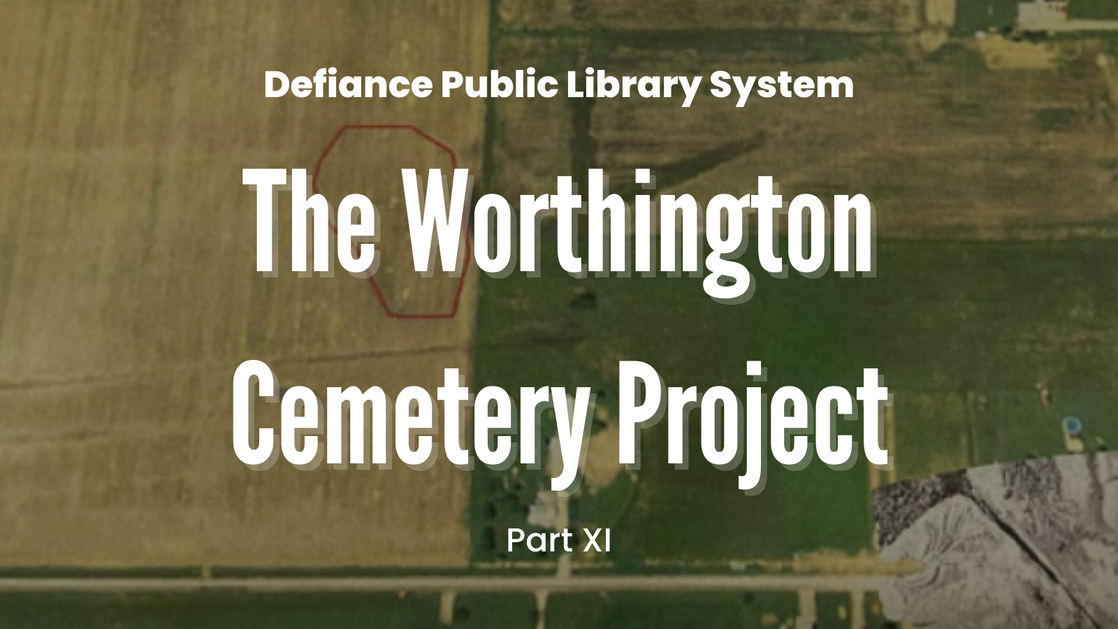
As you probably know from previous posts, in 2020, while researching a different historic cemetery, Sarah Marshall began finding references to an early Black cemetery in Highland Township dating to before the Civil War. This burial place had been established by Archibald Worthington, a successful Black farmer and freeman who was an early settler in Defiance County. Worthington is recorded as having donated a section of his land so that Black Defiance residents, who had no formal cemetery, would have a dignified place to be laid to rest. Worthington also appears to have offered part of his land for a church congregation, to which this cemetery might have been associated.
Since no headstones or markers remain on Worthington’s land, however, relocating the cemetery wouldn’t be a straightforward task. Sarah, along with Renee Hopper, utilized extant archival records and oral histories to hone in on the likely location of the cemetery. They also eventually enlisted the help of Jennifer Jordan Hall and Taylor Bryan of KYK9 Search and Reunite, who utilize K9s trained to detect scents associated with human decomposition. (Check out some of the previous posts about these efforts for a refresher!) Sarah and Renee’s work soon caught the eye of Eric Hubbard, a University of Pennsylvania Anthropology PhD candidate, Bronze Age archaeologist…and Defiance native. Eric realized that he might be sitting on the perfect archaeological tool to help investigate the location of the cemetery.
In recent years, many archaeologists have made use of remote sensing or subsurface geophysical technologies to help identify buried cultural heritage. These techniques make use of sonic energy, magnetism, electricity, temperature, and other properties to help researchers see changes in soil texture that could point to walls, pits, void spaces, and concentrations of objects that aren’t visible from the surface. Geophysical surveys are largely non-invasive, and much more time- and cost-effective than digging.
Eric realized that these technologies could be useful in helping Sarah and Renee relocate the Worthington cemetery. Indeed, he’d been involved in exactly this kind of survey work in Philadelphia, locating and assessing graves in a historic Black cemetery on behalf of a descendant congregation. GPR works by sending radio waves down into the ground; when this energy encounters a change in soil texture, some of it is reflected back to be picked up by a receiver. The receiver measures the time it takes for the energy to travel through the ground, bounce off of the texture change, and reflect back to the instrument — this is called the return time. With some math, archaeological geophysicists can use the return time to understand where and how far down into the ground the texture change is: in other words, to gauge the approximate location and depth of buried archaeological features.
After a grave shaft is dug and its occupant is laid to rest, the shaft is refilled with the soil and subsoil that was excavated to create it. This mixed-together dirt is softer and looser than the hard, compact earth around the shaft, meaning that radar energy travels faster through it than through the undisturbed dirt. When they reach the bottom of the grave shaft, the radio waves suddenly encounter a hard surface (in addition to any potential burial remains like a coffin), creating a strong reflection.
Eric recruited Chris LaMack, a classmate and fellow Penn archaeologist, to help plan and carry out a GPR survey of the area Sarah and Renee suspected was the site of Worthington’s cemetery. Dr. Jason Herrmann, a professor and specialist in archaeological geophysics in the Penn Museum’s Center for the Analysis of Archaeological Materials (CAAM), happily volunteered the Center’s GPR equipment, as well as a set of highly accurate GPS units and a camera-equipped drone, for the project.
For us, this radar survey would be an invaluable experience, a chance to carry out an archaeological geophysical project through from planning and data collection to post-processing and interpreting our findings. We were also inspired by Sarah and Renee’s passion for rediscovering this local Defiance heritage, and determined to help however we could.
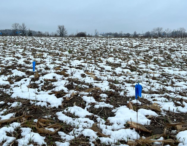
In late November of last year, we loaded CAAM’s equipment into Eric’s car and lit out for Defiance. After a day of road tripping, we arrived with just enough light left to take stock of the project area, a bare, furrowed field covered in fresh snow. Pin flags stood over the sites where K9s Pocket and Wick’s trained noses had detected possible human remains.

Up to our arrival, archival records and oral histories collected by Sarah Marshall and Renee Hopper pointed towards the cemetery’s location in an active agricultural field in Highland Township, east of the State Route 15 and Bowman Road intersection. In particular, a rectangular rise in the eastern half of the field oriented NE-SW. Difficult to discern when standing in the field itself, the rise is best visualized with a digital elevation model based on LiDAR data (Light Detection and Ranging), below. It was on the southern half of this rise that KYK9 performed their initial K9 HRD survey and detected the presence of human remains.

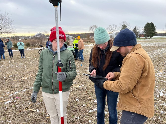
After some last-minute adjustments to the survey plan, fieldwork began in earnest early the next morning. We arrived at the Worthington site, shortly after daybreak, to a hearty NW Ohio welcome: coffee, donuts, and a half-dozen local volunteers eager to help. Sarah and Renee were there, as well as the inexhaustible Terry Howarth, who brought his Gator to help ferry people and equipment around the field.

First, we marked out the survey area and recorded the GPS positions of the corners, as well as the K9 HRD indications.
Radar data must be collected systematically by walking the antenna over the survey area in evenly spaced rows or transects. We settled on four transects per meter, rather than the typical two; this means that we moved the GPR unit across the survey area back and forth once every 25 centimeters, working our way across the field little by little from one side to the other in a kind of long zig-zag pattern. While increasing the number of transects increases the time needed to complete the survey, it also gives better resolution than a survey with fewer transects. This makes the final picture produced by the data after processing sharper to aid in our interpretation — a real boon, given how subtle the features we’re looking for tend to be.


The crowd swelled throughout the day as locals came out to visit and see archaeology in action. As we worked, we were joined by librarians, local history buffs, undergraduates from Defiance College, a Crescent News reporter — and long-time resident and Okinawa veteran, Nelson Okuley, who shared his memories of the area over the decades. The constant churn of friends and neighbors generated a lively buzz, turning the repetitive back-and-forth of the radar into a social event. Nearly all of these folks helped directly with the radar work; from collecting GPS coordinates, pulling 50-meter measuring tapes to guide the GPR transects, and moving equipment to actual data collection, the people of Defiance participated in every step of the fieldwork. Without this incredible community involvement, we would never have been able to survey as much of the site as we did: over 900 square meters of field, covered by nearly 200 radar transects. Put another way, we walked around 3.4 miles in all!


With some final drone images of the site, we finished up just before sundown, exhausted but beaming after a successful day of data collection. We celebrated over dinner with our gracious hosts for the weekend (Eric’s parents), reflecting on the fieldwork and speculating on what we might see come data processing time. The next morning, we packed up and made the long drive back to Philly.
Back at the Penn Museum, the work of processing and interpretation began. Using a software package called GPRSlice, Eric meticulously filtered, transformed, and reprojected the raw data in different ways in order to create legible images of what the radar “saw” beneath the ground surface. We looked at the radar profiles — greyscale images representing vertical “slices” into the ground beneath the radar as it moved along each transect — for any anomalous-looking reflections, surfaces of soil texture change that might be the edges or bottom of a grave shaft. We also studied the amplitude maps, which are horizontal slices made by cutting across a row of profiles stacked side-by-side. These images show where in the survey area the reflections are strongest at multiple depths. This is the stage in GPR processing where recognizable shapes — building foundations, ditches, the outlines of graves, etc. — occasionally begin to emerge. We carefully studied the images, taking note of and marking any anomalies that could be consistent with historic graves.

So did we find it? Could we see Archibald Worthington’s cemetery? The infuriating but simple truth is that it’s difficult to say. Archaeological geophysicists don’t trade in “smoking guns”: remote sensing evidence is rarely straightforward. Interpretation occurs alongside other strong lines of evidence and requires a knowledge of geophysics, as well as a bit of imagination. In order to create a robust interpretation, Eric, Chris, and their professor Jason Herrmann all independently looked through the processed data and created a set of points of interest. Where the three interpretations agreed formed the basis for a conservative estimate of potential grave-related anomalies. To combat against further interpretive bias, the distribution of K9 HRD indications were not consulted during the interpretation phase.
Overall, we recorded 11 anomalies which could be related to graves. However these showed no clear organization in rows or clusters. The clearest feature detected across the research area was a horizontal surface that occurred below the plow-zone, or the layer of earth that has been turned by plowing and tilling over decades of farming at the site. This surface is likely the boundary of a dense, lacustrine clay layer (known as Paulding County clay). In several cases, gaps observed in this layer were interpreted as places that may preserve where grave shafts cut through the denser clays. If these anomalies do represent graves, then, there is reason to be optimistic that the cemetery hasn’t been completely destroyed by later activity.

When evaluating these results, we need to keep two main points in mind:
- It is very unlikely that all possible graves in the research area were detected. There are a number environmental and cultural variables including burial method, age, soil conditions or agricultural activity that can impact the radar “visibility” of historic graves. It may be that some of the graves and their contents have deteriorated, or have been disturbed in some way, and that the contrast between these graves and the surrounding subsoil is much less than it originally was. This would make them less visible to GPR.
- It is also possible, owing to the complex stratigraphic environment, that some percentage of the anomalies identified will be false positives. In other words, they seem to look like graves, but are not. We can’t know for sure from the radar data alone which anomalies are graves and which are, say, isolated stones or evidence left by plowing or cutting drains in the field.
At first glance, our 11 GPR anomalies don’t overlap much with the HRD indications (see the maps below). However, when comparing these two surveys, it’s important to keep in mind that HRD dogs indicate where they detect human remains at the ground surface. So, Pocket and Wick’s indications aren’t necessarily exactly above graves so much as they are above the spot where scents are coming through the ground. (Hey, you try finding a 150+ year old burial with your nose!) According to Jennifer Jordan Hall of KYK9, the dogs indicate, on average, within two meters (6 ½ ft.) of the actual location of a grave (based on their past cases where burials were excavated). This means that, even though our radar anomalies aren’t precisely in the same spots that the dogs marked, we can still be encouraged by how close they are. In fact, nearly half of the radar anomalies fell within two meters of at least one K9 HRD indication.

In this context, the generally flat topography and poor drainage of the Paulding County clays that make up the field’s soils could work in favor of the scent’s remaining close to their sources. And if the GPR anomalies do turn out to be graves, their alignment with the K9 HRD indications could support the notion that some of these graves do remain intact and have not entirely been destroyed.
After Eric reported on our findings to Sarah and Renee, it was decided to invite the KYK9 team out for further HRD dog fieldwork. That survey happened in early April, with Eric back home for Easter to help out and see K9s Pocket and Wick in action. One big question was whether the dogs would indicate outside of the suspected cemetery area. If they did, it could be a sign that either we had surveyed in the wrong place, or — more troubling — that the graves had indeed been compromised by plowing which spread the scent of human remains across the field. However, if the dogs were only interested in the geographic rise where both the Defiance library team and the Penn radar team had tentatively located Worthington’s cemetery, then this would be strong evidence supporting our interpretation of the site.
To test this, four distinct HRD survey areas were established. The first covered an area of the rise just north of where the dogs had worked the last time they were out; this area included a small 10×10 meter space where our GPR work had recorded some interesting anomalies. The other three survey areas were placed elsewhere in the field, away from previous survey areas. To everyone’s excitement, K9s Pocket and Wick had almost no interest in any part of the field save for one: the rise where we suspected the cemetery had been. The dogs’ noses even led them back toward the sections where we had worked with the radar in November, strengthening our confidence in what we thought we saw in the data.


So what’s next? While both GPR and K9 HRD combine to recommend the rise in the field as the likely location of Worthington Cemetery, we don’t know how many burials it contains or what its original boundaries were. The recent HRD dog work produced several indications of human remains in a part of the rise that hasn’t yet been covered by radar survey, raising the possibility of future GPR fieldwork.
The only way to really confirm what we saw in the radar data is with some form of ground truthing; this could be something like soil coring or surface scraping to determine whether or not the GPR features we recorded are associated with soil color and textual differences below the plow zone characteristic of graves. Though they only intend to affect the already disturbed plow zone, these methods are more invasive and destructive.
While ground truthing might help us to finally resolve our questions about Archibald Worthington’s cemetery, the team’s first and foremost concern is to proceed respectfully. After all, this was a place where friends and loved ones, parents and children, were laid to rest. The goal of finding the Worthington cemetery is to honor them, and to commemorate the community they helped build in Northwestern Ohio. No work that would disturb their resting places should be done without the permission of their descendants. Our fieldwork will remain non-invasive, using remote sensing tools, until potential descendent stakeholders can be located and involved in future research plans.
Recovering roots, celebrating local heritage, and telling stories that don’t “fit” the bigger histories we learn in school — that’s what doing “archaeology in your hometown” is all about. As always, stay tuned for more updates on this research into Worthington and his cemetery — and look for a poster at the library! HUGE round of applause for everyone who came out to help with this fieldwork; we hope to see you all out there again!